| Proposed Barossa Valley Powerline | ||||
| Electranet SA operates and manages the electricity transmission network throughout the State of South Australia.
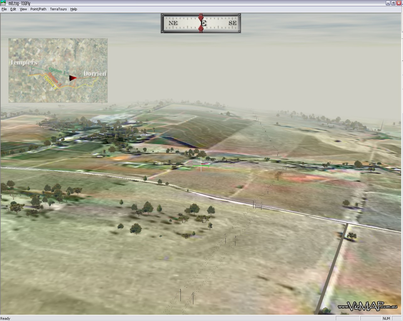
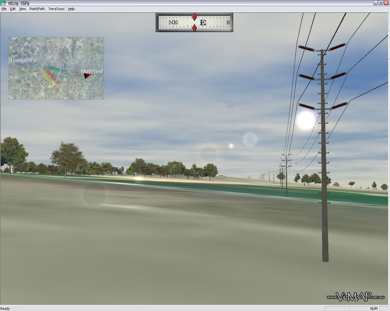
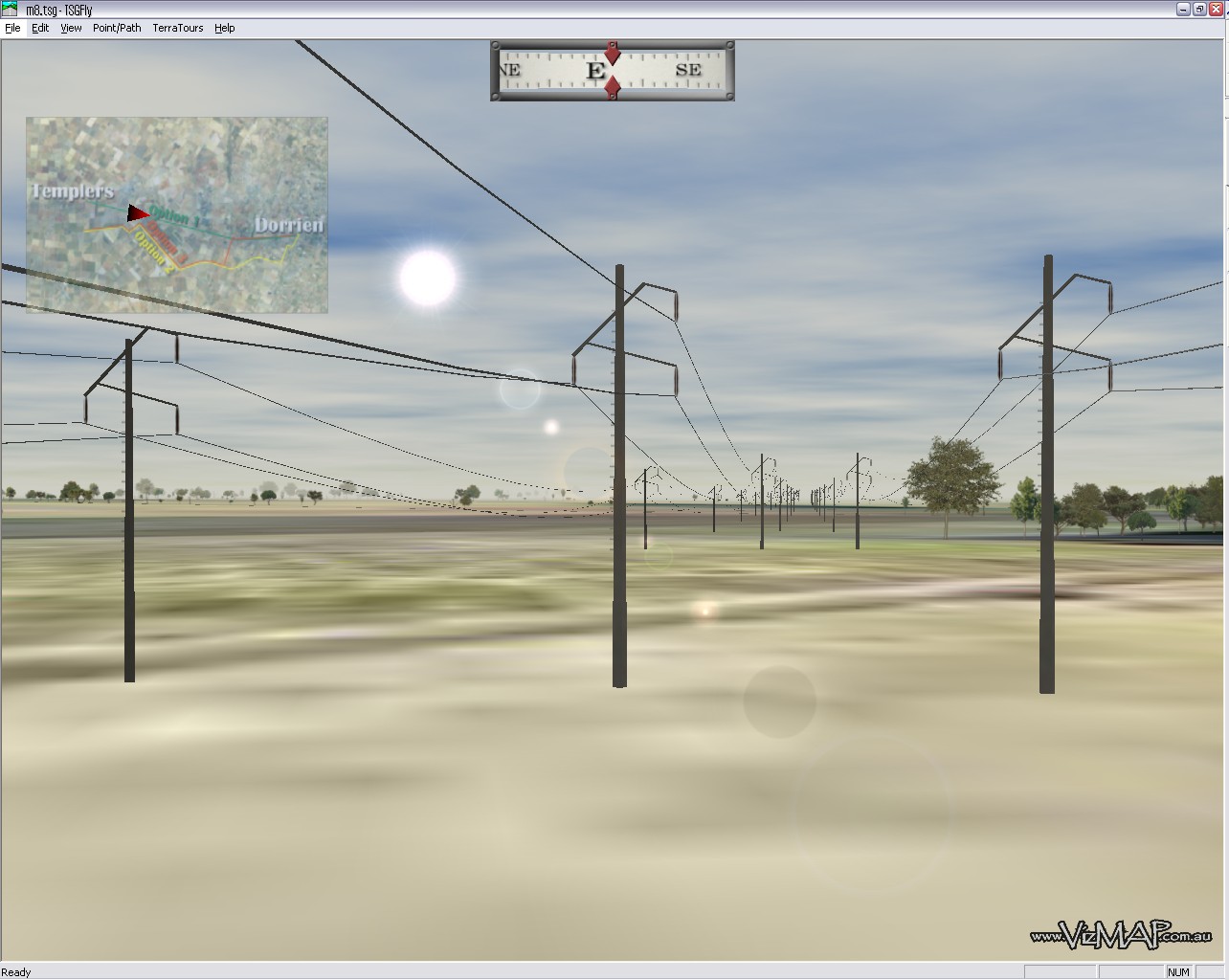
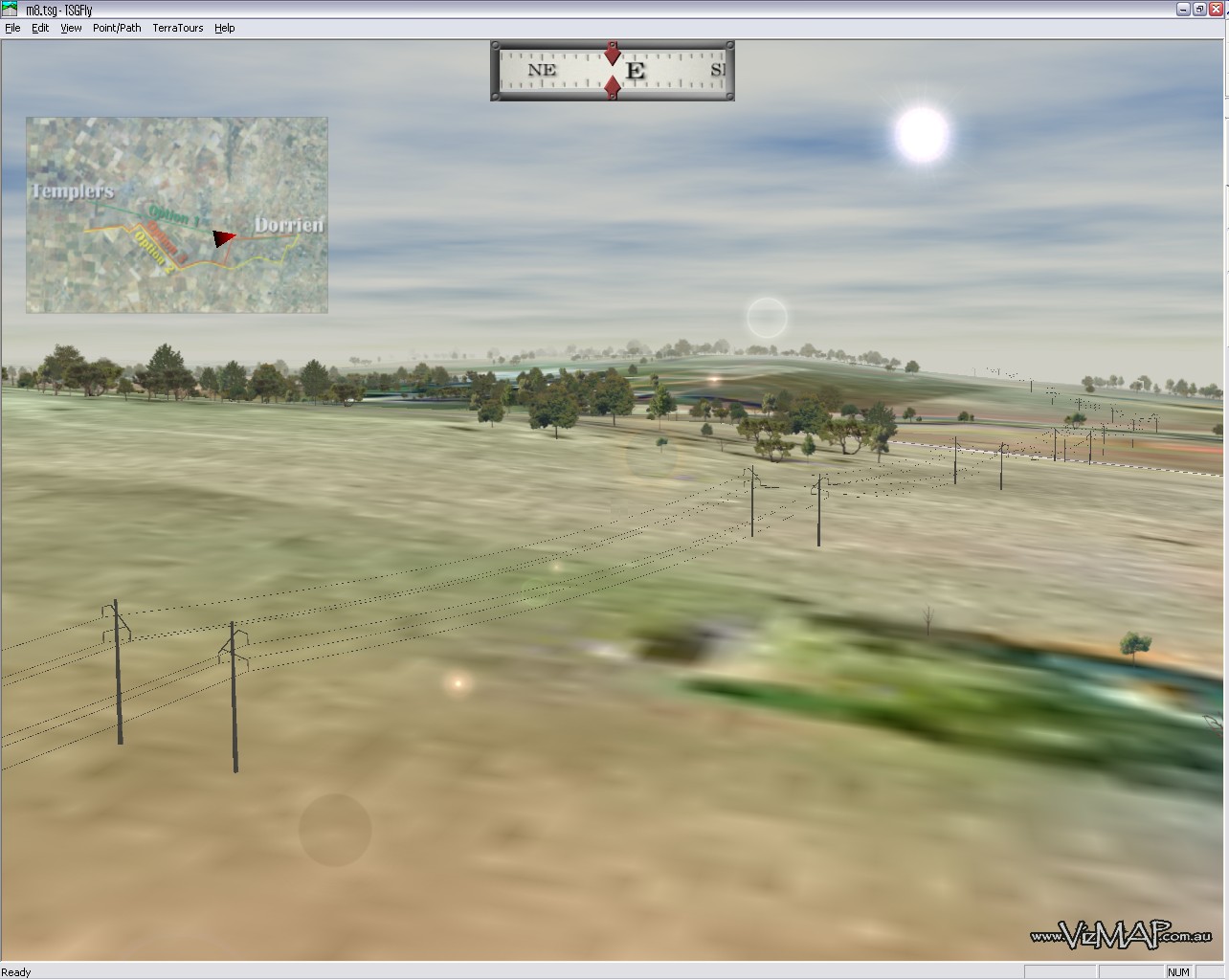
Electranet SA engaged VizMAP Pty Ltd to create a geospatial Visualisation of the proposed Templers to Dorrien 132kV transmission line for the purpose of public consultation and internal Electranet SA discussions and planning. During the route selection and environmental impact assessment phases of a transmission line project, one of the issues foremost in the minds of those responsible for selecting possible alignments is the visual impact of the proposed infrastructure. The method most widely used in the past for visualising a transmission line has been to pre-determine vantage points along a proposed alignment, and superimpose tower outlines and conductor catenaries on photos taken from these vantage points. In an attempt to meet community expectations of being able to get a clearer idea of what the structures and conductor catenaries of a new transmission line might look like, a digital model is required that will deliver continuous visualisation of the proposed alignment. Such a model also assists in locating the best alignment for the proposed line from a visual aspect by being able to continually view the alignment from any point in the general area of the line. The model also assists in the production of environmental impact reports.
Click on these small resampled images to view the full screen images on the VizMAP website. Bear in mind that these are just screen dumps from a dynamic, interactive, 3D "flythrough".
If you would like more information on this project, let VizMAP know. |
||||
| If you have a need to dynamically visualise your geographic data, let VizMAP know your requirements… |
|
|
||||||
Barossa Valley Powerline |
||||||
Powered by WordPress & Atahualpa |
||||||