vol 2 num 5

from VizMAP – letting you see where you stand…
Volume 2 – Number 5
|
| About VizMAP
VizMAP Pty Ltd, is a leading supplier of terrain Visualisation and related services to the defence, GIS, environmental, mapping, mining and exploration industries, engineering and construction firms, developers and planners, as well as government administration departments dealing with land, transportation and the environment.
VizMAP‘s products are designed to be run on reasonably to highly configured graphics computers (PC, Linux and Unix) for public display, group training, mission rehearsal, environmental monitoring, etc. and to enhance management decision making.
VizMAP is headquartered on Queensland’s Sunshine Coast (Australia) with affiliation in Asia, Europe, Africa and the USA and thereby provides support and services to customers worldwide.
If you need to visualise anything geographic, e-mail VizMAP here with the details.
For more information about VizMAP visit the VizMAP Web site at http://www.vizmap.com.au.
|
VirtualGeography
Subscription
Details
To subscribe to VirtualGeography,
click here.
To unsubscribe to VirtualGeography,
click here.
|
A Moment’s Notice
"A new study shows that licking the sweat off a frog can cure depression. The down side is, the minute you stop licking, the frog gets depressed again."
— Jay Leno  |
|
VirtualGeography – the newsletter
|
| G’Day… and Welcome to VirtualGeography |
from VizMAP |
| Welcome to the more printer friendly version of the free VirtualGeography from VizMAP Pty Ltd.
I have to apologise again that this one is a little late but I’m still currently on a Land Administration assignment in the Solomon Islands and not only is my available time after hours to prepare the VG limited, but the local tech support have given me internal mail here at the Solomon Islands National Land Centre at the expense of all my external/internet accounts (including my VirtualGeography account, no less). Needless to say there has been a lot of stuff happening in the background here. Not to say that I don’t enjoy it – the VG makes me keep up with our industry in the rest of the world, which sometimes, seems a very, very long way away, SARS and Iraq notwithstanding.
VirtualGeography is a collection of interesting snippets from all over the shop, dealing with industry issues concerning the computer based visualisation of geography and a few other associated (or otherwise) interesting bits and pieces. You are receiving this either because you subscribed to VirtualGeography or you have had recent dealings with VizMAP Pty Ltd. If you do not wish to receive further instalments of VirtualGeography, just click on the unsubscribe link at the bottom of this e-mail.
A new VirtualGeography is pushed out about once per month, towards the end of the month, which shouldn’t be too big a drain on your mailbox if you’re not already subscribed (of course it won’t be a drain on your mailbox if you ARE subscribed, either ). If you know of anyone who might like to get VirtualGeography, feel free to forward this to them and ask them to subscribe. By the way, subscription and unsubscription details are at the bottom (click here).
So, g’day to all you enthusiasts requiring to visualise and simulate both urban and rural geographic information (GIS), cartography, photogrammetry, remote sensing, digital elevation modelling (DEM) and general mapping.
|
By the spelling of "Visualisation" you may have already guessed that we’re not US based – that’s a good thing, or at least not a bad thing. This comes to you from Mooloolaba on the Sunshine Coast of Queensland, Australia, where it’s beautiful one day and perfect the next.
The link between visualisation and mapping may seem a little esoteric if this is your first encounter with this sort of stuff, but let me tell you, the bond is significant… but enough of that: on with the show… I hope you like it. Any feedback you might have is highly appreciated. E-mail me hereto make your comments.
Enjoy…
Graeme Brooke
VizMAP Pty Ltd
|
 |
P.S. You’ll need an active internet connection to view any images that are in the content. We’ve done it this way to keep the size of the e-mail to a minimum.
|
| |
Back to Top |
| The Industry’s Two Cents Worth… |
| Scenegraphs: Past, Present and Future |
from RealityPrime |
| In the Beginning…
To help understand where scenegraphs came from, it’s useful to take a quick look at the evolution of graphics languages like OpenGL and DirectX. Early on, real-time graphics existed on special image generation (IG) hardware that contained entire visual databases in closed proprietary form. Modellers created their databases and loaded them onto the hardware IG. Programmers were generally limited to modifying elements of these databases, like the position and rotation of a helicopter or setting the time-of-day.
SGI introduced a more open and programmable option for image generation hardware and along with it, graphical languages that allowed more direct programmability of the image pipeline. OpenGL (from SGI’s original "GL") consists of a stream of primitive drawing commands (draw polygon, line, point, etc..) state settings (set color, texture, etc..) and matrix manipulations (push/pop to model-view or perspective matrix, etc..). But it contains very little information that allows the system to self-optimize and improve performance.
This was fine for drawing all sorts of scenes. But polygons that are out of view do consume resources – the hardware doesn’t even know they’re out of view until very late in the rendering pipeline. Unnecessary state changes, extra texture loads, and other common graphics procedures are best avoided if they don’t contribute to the final image.
|
| Read that full story here |
Back to Top |
| Hardcore Stuff (hardware bits)… |
| BP Deploys HP Intel® Itanium® 2-Based Systems for Seismic Imaging Research |
from HP |
| Intel Itanium 2-Based Solution Running Linux Delivers Significant Price-Performance Improvement, Time Savings for Oil, Gas Exploration
Intel Corporation and HP (NYSE:HPQ) today announced that BP, one of the world’s largest petroleum and petrochemicals companies, has added new and additional computing capabilities to its advanced seismic research facility. The research facility will benefit from the addition of HP Intel® Itanium® 2-based systems running Linux, resulting in dramatically faster seismic imaging.
Based in Houston, BP’s advanced seismic research center now includes a high-performance computing (HPC) cluster of 259 HP rx5670 systems with more than 1,000 Itanium 2 processors, providing a total of 4 teraflops and 8000 GB of memory, running under the Linux operating system. The HP Server rx5670 is part of HP’s broad portfolio of industry-standard Itanium-based hardware for enterprise customers. Using HP’s Itanium 2-based systems running Linux as well as Intel and HP software, compilers and tools, BP has achieved a significant increase in computing power, resulting in clearer images of the Earth’s subsurface structures and the hydrocarbons they contain.
"To achieve the most cost-effective and productive drilling procedure, we have to gather massive sets of seismic data and analyze them quickly and accurately," said Keith Gray, manager of BP’s HPC center. "The combination of HP Itanium 2-based servers running Linux and software tools and services from Intel and HP gives us the power to produce better-defined results in a fraction of the time."
"The BP seismic solution illustrates the growing momentum for Itanium 2-based systems in heavy-duty enterprise computing," said John Davies, vice president, Sales and Marketing Group and director, Intel’s Solutions Market Development Group. "By using Itanium 2-based systems to run one of the most powerful commercial computing centers in the world, BP is able to take advantage of the world-class reliability, scalability and power provided by the Itanium 2 processor."
|
| Read that full story here |
Back to Top |
| Softcore Stuff (software and data bits)… |
| OpenSceneGraph-0.9.4 |
from OpenSceneGraph.org |
| The most significant new feature is the osgProducer library that adds tight integration with OpenProducer, providing the OpenSceneGraph with a scalable, configurable and portable framework for developing real-time and interactive graphics applications. The scalability afforded by OpenProducer allows applications to be developed which run seamlessly on single pipe machines up to multi-pipe machines such as Sgi Onyx IR system, and Sun Zulu systems. The osgProducer/OpenProducer framework automatically handles the multi-threading of cull-draw pairs and GUI events.
All the example programs have been ported over from being based on GLUT to using osgProducer (osgGLUT can now be found in the bazaar section on the website). The move to osgProducer allows all the examples to scale from running on laptops up to multiple CPU and graphics pipe systems. The configuration of threading and multiple camera views can all be done via ASCII configuration files, no need to recompile. A number of new examples have also been added or revamped, bringing the total to 42.
Also in the theme of increasing scalability there is support for 64bit Linux for both IA64 (Intel Itanium) and x86-64 (AMD Opteron) which compliments the existing support for Solaris and IRIX 64 bit compilation. 64 bit supports allows the use of very large data sets, and potential performance improvements.
To help support development teams working with multiple build configuration, the makefile system has been extended to allow multiple build targets to be built from one source code base. All makefiles are also now named GNUmakefile which ensures that they are only run by gmake to avoid an confusion on system where gmake isn’t the default make tool.
|
| Read that full story here |
Back to Top |
| Bondi |
from VizMAP |
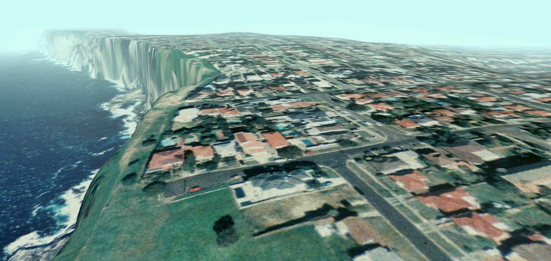
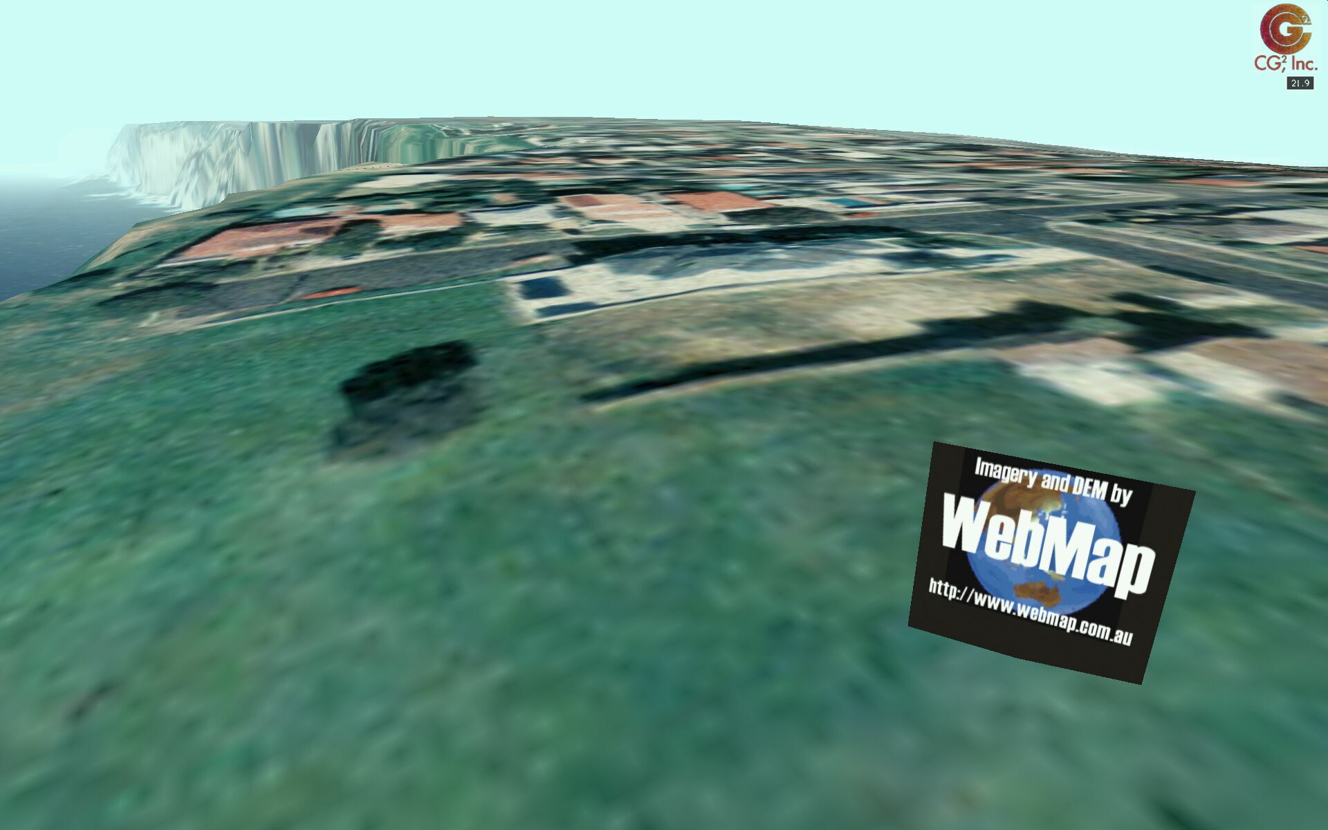
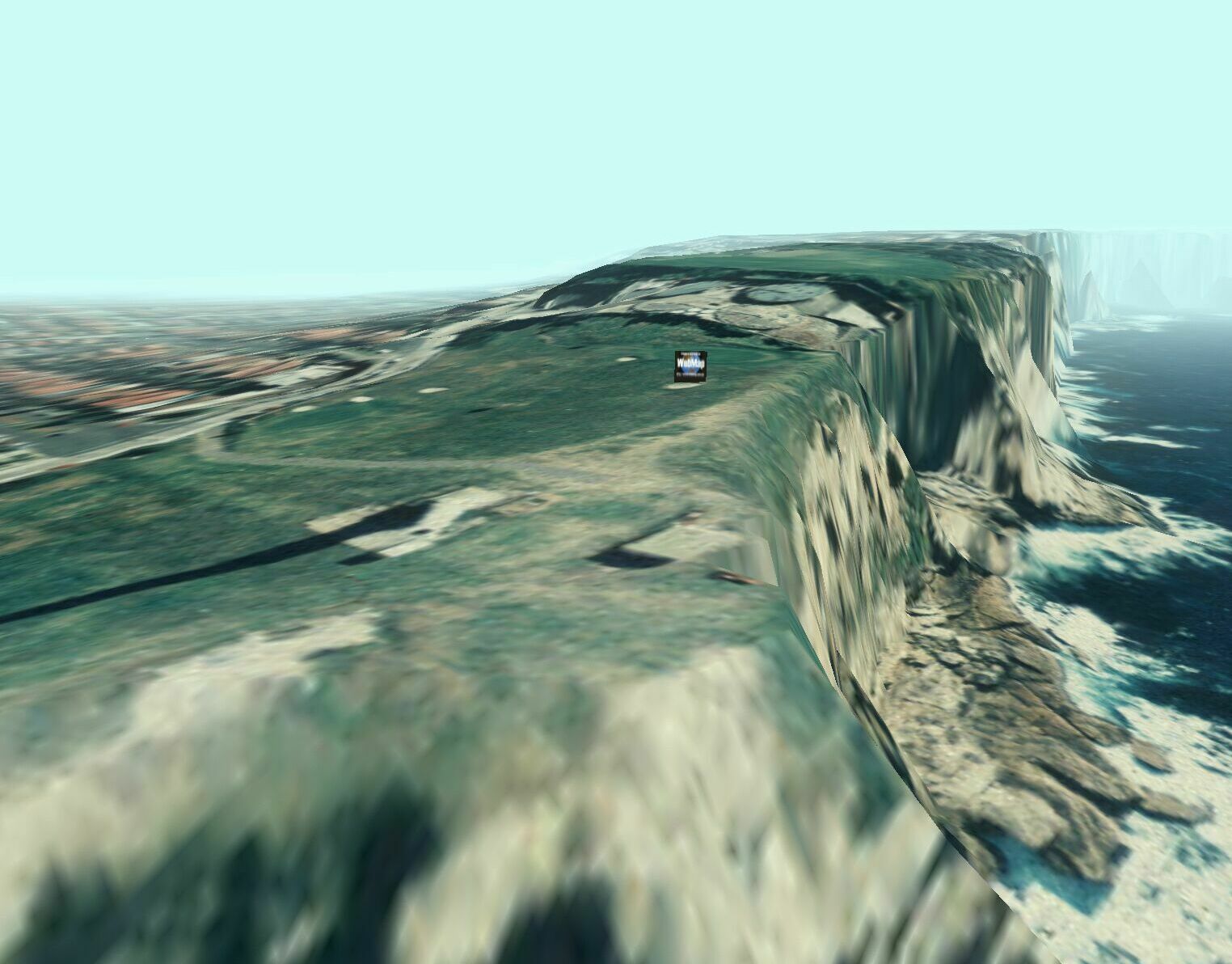
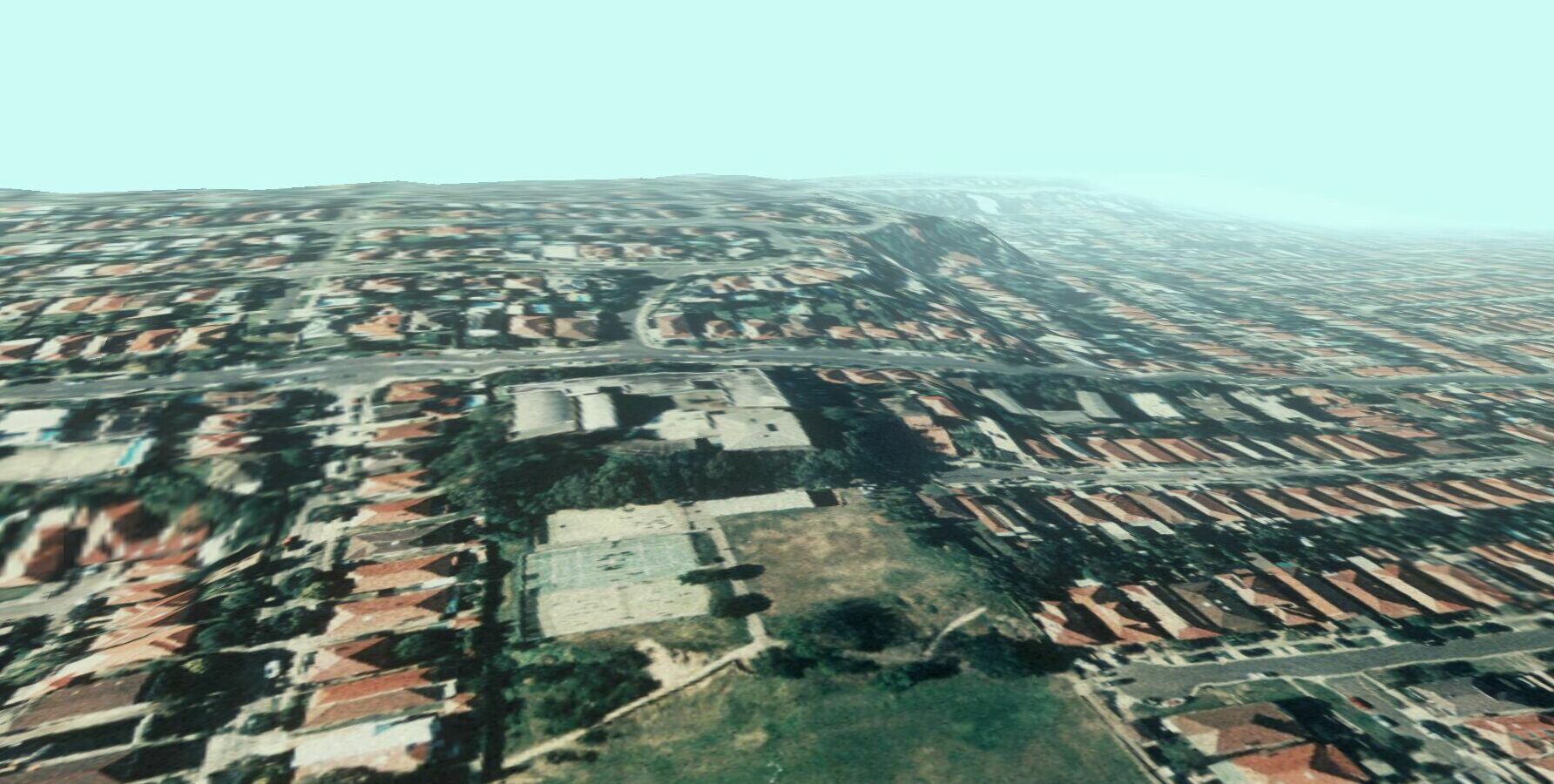
| VizMAP created a vis/sim database for WebMap in Brisbane using WebMap’s DEM and orthoimagery over Sydney’s Bondi.
Sample still images from the completed dynamic visualisation database are displayed here. An active internet connection is required to be able to view these scenes.
Click on these small resampled images to view the full screen images on the VizMAP website. Bear in mind that these are just screen dumps from a dynamic, interactive, 3D "flythrough".
|
| If you have a need to dynamically visualise your geographic data, let VizMAP knowyour requirements… |
Back to Top |
| Experts target junk e-mail |
from the BBC |
| A three-day meeting in Washington on junk electronic mail has closed with a call for immediate action to be taken.
Users can be deluged by unwanted emails
The conference, organised by the Federal Trade Commission, was looking at the proliferation of commercial e-mail and exploring the technical, legal and financial issues that spam raises.
Speakers at the conference painted a gloomy future for e-mail unless the problem of spam is immediately addressed.
A Federal Trade Commission representative said things were worse than they had imagined and without immediate improvements, e-mail could be run into the ground.
Internet providers said it was the sheer number of messages that posed the threat.
Strategies
There were different views on the best way to tackle the problem of spam, which now accounts for more than 40% of e-mails.
Many at the forum suggested new countrywide legislation was needed in the United States, but others said the only solution was to block spam with new technology.
The forum brought together internet providers, anti-spam campaigners and Washington policy makers, but it also heard from e-mail marketers, who maintained that reputable operators only sent messages to consumers who wanted to hear from them.
|
| Read that full story here |
Back to Top |
| Whazzup Next – with 20/20 Foresight… |
Stuff to look out for in May, June & July
| Legend |
| Included in last issue… |
| Updated since last issue… |
| New since last issue… |
|
This calendar of events has been collated from:
|
| May 2003 |
| 4-7 May, 2003 |
ESRI International Health User Conference |
Arlington, VA USA |
| 4-8 May, 2003 |
EDS Conference on Desalination and the Environment "Fresh Water for All" UN Year of Fresh Water |
Malta |
| 5-6 May, 2003 |
2003 Online Water Management Symposium |
USA (Internet) |
| 5-7 May, 2003 |
IMAGIN 2003 Conference |
Kalamazoo, MI |
| 5-9 May, 2003 |
ASPRS 2003 |
Anchorage, AK USA |
| 5-9 May, 2003 |
Water Distribution Modeling Symposium |
Perugia, Italy |
| 5 May -13 June, 2003 |
Thirteenth United Nations/Sweden International Training Course on Remote Sensing Education for Educators |
Stockholm and Kiruna,
Sweden |
| 7-9 May, 2003 |
GeoAlberta 2003 |
Calgary, Alberta, Canada |
| 9-14 May, 2003 |
Socio-Economic Research and Geographic Information Systems |
Spa, Belgium |
| 11-16 May, 2003 |
Fifth Science and Management of Protected Areas Conference (SAMPA V) |
Victoria, British Columbia, Canada |
| 12-14 May, 2003 |
Using Voice-Enabled Wireless and Multimodal Applications to Drive Business Revenues |
Chicago, IL USA |
| 12-16 May, 2003 |
GIS BRASIL 2003 – 9th GEOTECHNOLOGIES TRADESHOW |
São Paulo City, São Paulo State, Brazil |
| 12-16 May, 2003 |
GTC West 2003 |
Sacramento, CA USA |
| 12-16 May, 2003 |
United Nations/Thailand Workshop on the Space Technology Contributions to Bridge the Digital Divide |
tbr, THAILAND |
| 13-15 May, 2003 |
2003 Nebraska GIS Symposium |
Lincoln, Nebraska USA |
| 14 May, 2003 |
San Francisco Bay Area ESRI User Group Meeting |
San Francisco, CA USA |
| 14-16 May, 2003 |
Eurimage International Meeting 2003 |
Frascati, Rome, Italy |
| 15-16 May, 2003 |
Avenza Systems Training |
Denver, CO USA |
| 15-17 May, 2003 |
EASY-ECO 2 |
Vienna, Austria |
| 18-22 May, 2003 |
2003 Bentley International User Conference |
Baltimore, MD USA |
| 18-23 May, 2003 |
21st AARB and 11th REAAA (Road Engineering Association of Asia and Australasia) Joint Conference – Transport – our highway to a sustainable future |
Cairns, Qld, Australia |
| 18-23 May, 2003 |
GeoTech Western Colorado |
Grand Junction, Colorado, USA |
| 19-21 May, 2003 |
GeoSpatial World 2003 |
New Orleans, LA USA |
| 19-21 May, 2003 |
MOBILE AMERICAS 2003 |
Miami, FL USA |
| 19-23 May, 2003 |
United Nations/Romania Regional Workshop on the Use of Space Technology for Disaster Management for Europe |
Sinaia, ROMANIA |
| 21 May, 2003 |
URISA – Give & Take: National Programs … Local Implementation |
Washington, DC USA |
| 22-23 May, 2003 |
2nd Joint ISPRS WG III/6 /IEEE Workshop on Remote Sensing and Data Fusion over Urban Areas (URBAN 2003) |
Berlin, GERMANY |
| 24 May, 2003 |
GEOIDE 5th Annual Scientific Conference |
Victoria, British Columbia, Canada |
| 25-28 May, 2003 |
11th International Symposium on Deformation Measurements |
Santorini, GREECE |
| 26-28 May, 2003 |
8th ISU Annual International Symposium Satellite Navigation Systems: Policy, Commercial and Technical Interaction |
Strasbourg, France |
| 26-29 May, 2003 |
SimTecT 2003 — ‘Simulation – Delivering Tomorrow Today’ |
Adelaide, South Australia, Australia |
| 26-29 May, 2003 |
3rd International Conference on GIS – for Earth Science Applications |
Ljubljana, Slovenia |
| 27-29 May, 2003 |
8th International Conference on Computers in Urban Planning and Urban Management |
Sendai, Japan |
| 27-31 May, 2003 |
CAG 2003 ACG |
Victoria, British Columbia, Canada |
| 28 May, 2003 |
UVic Geography Alumni Lunch |
Victoria, British Columbia, Canada |
| 28-31 May, 2003 |
1st Taipei International Conference on Digital Earth |
Taipei, TAIWAN |
| June 2003 |
| 2-3 Jun 2003 |
TUGIS 2003, the 16th Annual GIS Conference |
Baltimore, MD USA |
| 2-5 Jun 2003 |
23rd EARSeL Annual Symposium "Remote Sensing in Transition" |
Gent, Belgium |
| 2-5 Jun 2003 |
AEC Systems 2003 |
Washington, USA |
| 2-6 Jun 2003 |
International Symposium on Spectral Sensing Research (ISSSR 2003) ISPRS WG VII/1 |
Santa Barbara, CA, USA |
| 2-6 Jun 2003 |
ISSRM 2004 (International Symposium of Society and Resource Management) 2004 |
Keystone Resort, Colorado USA |
| 2-6 Jun 2003 |
EARSEL Symposium |
Gent, Belgium |
| 6-7 Jun 2003 |
EARSeL Workshops – "Forest Fires and Coastal Zones" |
Gent, Belgium |
| 3 Jun 2003 |
GITA Webinar… Geospatial Information: Government and Municipal Perspectives |
WWW |
| 3-6 Jun 2003 |
ISPRS WG IV/8 Workshop "Global Environmental Databases: Adaptation to Meet Current & Future Needs" |
Bangkok, Thailand |
| 4-6 Jun 2003 |
ScanGIS’2003 – The 9th Scandinavian Research Conference on Geographic Information Science |
Espoo, Finland |
| 5 Jun 2003 |
SmartTalk Events |
USA (internet) |
| 5-6 Jun 2003 |
Emerging Technology Summit II: Spatial Web Services |
Vienna, Virginia USA |
| 6-7 Jun 2003 |
EARSeL Workshops "Forest Fires and Coastal Zones" |
Gent Belgium |
| 6-7 Jun 2003 |
MapServer User Meeting |
St. Paul, Minnesota, USA |
| 9-12 Jun 2003 |
e-Gov 2003 |
Washington, DC USA |
| 9-13 Jun 2003 |
SGEM 2003 – Surveying, Geology and Environmental Management |
Albena, Bulgaria |
| 11-12 Jun 2003 |
Spatial Data Analysis Training |
Ann Arbor, Michigan USA |
| 12-13 Jun 2003 |
FME Training |
Vancouver, BC, Canada |
| 12-13 Jun 2003 |
Introduction to Boundary Analysis using BoundarySeer |
Ann Arbor, Michigan USA |
| 15-18 Jun 2003 |
IST Mobile & Wireless Communications Summit 2003 |
Aveiro, Portugal |
| 17-19 Jun 2003 |
ISPRS Joint Workshop of WG I/3 and WG II/2: Three-Dimensional Mapping from InSAR and LIDAR |
Portland, OR, USA |
| 19-20 Jun 2003 |
Spatial Futures 2003 |
Sydney, New South Wales, Australia |
| 19-20 Jun 2003 |
Status of GIS in NSW 2003 |
Sydney, New South Wales, Australia |
| 23-23 Jun 2003 |
GeoTech 2003 |
Copper Mountain, Colorado USA |
| 23-26 Jun 2003 |
The 2003 International Conference on Machine Learning;Models, Technologies and Applications (MLMTA) |
Las Vegas, Nevada, USA |
| 24-25 Jun 2003 |
Pennsylvania GIS Conference 2003 |
Harrisburg, PA USA |
| 24-27 Jun 2003 |
Space 2003-NavSat 2003 CHINA |
Geneva, Switzerland |
| 24-25 Jun 2003 |
11th Annual Pennsylvania GIS Conference |
Harrisburg, PA USA |
| 25-26 Jun 2003 |
2003 GenaWare Annual Symposium |
Durham, NC USA |
| 25-27 Jun 2003 |
The 11th International Conference on Geoinformatics’ 2003: Advanced Geoinformatics – Linking Pacific Rims to the World |
Toronto, Canada |
| 26-27 Jun 2003 |
Web-Enabled GIS Technologies Forum |
Melbourne, Victoria, Australia |
| 27 Jun 2003 |
Cumberland Group of Surveyors’ Development Seminar |
Warwick Farm, NSW, Australia |
| 27-29 Jun 2003 |
ISPRS WG VII/4 4th International Symposium "REMOTE SENSING OF URBAN AREAS 2003" |
Regensburg, Germany |
| 30 Jun – 11 Jul 2003 |
23rd IUGG General Assembly "IUGG 2003" |
Sapporo, Japan |
| July 2003 |
| 1-3July 6-9, 2003 |
ISPRS Workshop ‘Vision Techniques for Digital Architectural and Archaeological Archives’ |
Ancona, Italy |
| 2-4 July, 2003 |
AGIT 2003 – 15th Symposium and Exposition for Applied Geoinformatics |
Salzburg, Austria |
| July 6-9, 2003 |
ESRI Education User Conference |
San Diego, California, USA |
| July, 7-8, 2003 |
Coastal GIS 2003: an integrated approach to Australian coastal issues |
Wollongong, NSW, Australia |
| July 7-11, 2003 |
International ESRI User Conference |
San Diego, California, USA |
| July 7-14, 2003 |
Tech Ed 9th Annual Summer Camp |
Bedford, New Hampshire |
| July 9-11, 2003 |
ISPRS WG II/3, IV/2 and IV/4 Joint Workshop on Advances in Spatial Data Infrastructures & Database Interoperability |
Southampton, UK |
| July 10-11, 2003 |
ISEIS 2003 Annual Conference on Systems Science and Information Technology for Environmental Applications |
Regina, CANADA |
| July 10-11, 2003 |
Avenza Systems Training |
San Diego, CA USA |
| July 10-12, 2003 |
Association of Surveyors of Papua New Guinea Conference |
Port Moresby, PNG |
| July 13-17, 2003 |
Coastal Zone 2003 |
Baltimore, Maryland, USA |
| July 13-17, 2003 |
Association of Pacific Coast Geographers, 2003 Annual Meeting |
Portland, Oregon, USA |
| July 13-19, 2003 |
SVG Open 2003 |
Vancouver, Canada |
| July 16-18, 2003 |
MultiTemp-2003: Seconde International Workshop on the Analysis of Multi-Temporal Remote Sensing Images |
Ispra (VA), Italy |
| July 16-18, 2003 |
ISPRS WG III/2 & III/8 Workshop – "From surface reconstruction to 3D scene analysis in digital imagery: theory, applications and evaluation" |
Paris, FRANCE |
| July 17-19, 2003 |
Map Asia 2003 |
Kuala Lumpur, Malaysia |
| July 17-19, 2003 |
Laser-Scan User Group 2003 Conference |
Cambridge, UK |
| July 20-22, 2003 |
2nd Annual PPGIS Conference |
Portland, OR USA |
| July 20-23, 2003 |
URISA 2nd Annual Public Participation GIS Conference (PPGIS) |
Portland State University, USA |
| July 20-24, 2003 |
GML Dev Days 2003 |
Vancouver, BC, Canada |
| July 20-25, 2003 |
Cambridge Conference 2003 – ‘National mapping – shaping the future’ |
Cambridge, Cambridgeshire, UK |
| July 21-25, 2003 |
IEEE/IGARSS 2003 International Geoscience and Remote Sensing Symposium |
Toulouse, France |
| July 22-25, 2003 |
SatNav 2003, the 6th Int’l Symp. On Satellite Navigation Technology |
Melbourne, Victoria, Australia |
| July 23-24, 2003 |
Underground Focus Live |
Manteno, Ill, USA |
| July 28-31, 2003 |
Accela Government Automation Conference |
Las Vegas, NV USA |
| 28 July – 8 August 2003 |
The Vespucci Initiative – Summer School on Geographic Information Science |
Florence, Italy |
|
| |
Back to Top |
| A Parting Gesture… |
| The Garden of Eden |
From JokeADay |
After the fall in the Garden of Eden, Adam was walking with his sons Cain and Abel.
They passed by the ruins of the Garden of Eden. One of the boys asked, "What’s that?"
Adam replied, "Boys, that’s where your mother ate us out of house and home." |
|
Back to Top |

Feel free to forward this to whomsoever you wish.
To e-mail the VirtualGeography Editor, click here.
To subscribe to VirtualGeography, click here.
To unsubscribe to VirtualGeography, click here.
…that’s all, folks! (for now).
|
|
VizMAP
- Bureau & Services Portfolio
- Contact Us
- News
- Gladstone Port Access Road nearly complete after VizMAP visualisation convinces Council
- TerraTools Exporter for Virtual Battlespace 2 (VBS2) Now Available – 23/3/9
- Updated interactive “Flash Map” of Advanced Mining Projects in Queensland by VizMAP to be distributed to delegates of Mining 2006
- VizMAP & E2E deliver workshop at Queensland Spatial Conference, Brisbane, Queensland – 17/7/8
- VizMAP creates “virtual trek” to the Everest Base Camp
- VizMAP creates virtual coal mine for central Kalimantan
- VizMAP develops interactive “Flash Map” of Advanced Mining Projects in Queensland
- VizMAP imagery of Virtual Surat Energy Province awarded image of the month by Image Society Inc.
- VizMAP Launched
- VizMAP launches FlyLG: computer based geospatial Visualisation tailored to Australian local government areas
- VizMAP presents at Australia Pacific Spatial Innovation Conference 08, Canberra, ACT – 19/11/8
- VizMAP presents at GITA 07, Brisbane, Queensland – 8/8/7
- VizMAP presents at GITA Seminar, Darwin, Northern Territory – October, 2006
- VizMAP presents at Queensland Spatial Conference 2008, Brisbane, Queensland – 18/7/8
- VizMAP presents at Surveying and Spatial Sciences Institute (SSSI) Meeting, Hervey Bay
- VizMAP Presents TerraTours® Visualization at World Energy Congress
- VizMAP presents to Darling Downs Interest Group in GIS and Remote Sensing (DIGGARS) Seminar, USQ, Toowoomba, Queensland – 8/11/7
- VizMAP presents to International Map Trade Association (IMTA), Surfer’s Paradise, Queensland – 2/11/7
- VizMAP presents to Queensland Spatial Industry Council (QSIC), Brisbane, Queensland – 22/11/7
- VizMAP writes for Position Magazine – “The 3D Industry” – April-May 2007, No 28
- VizMAP’s Virtual Surat Energy Province
- VirtualGeography Index
- VizMAP
|