| Proposed Coking Coal Mine in Central Kalimantan | ||||||
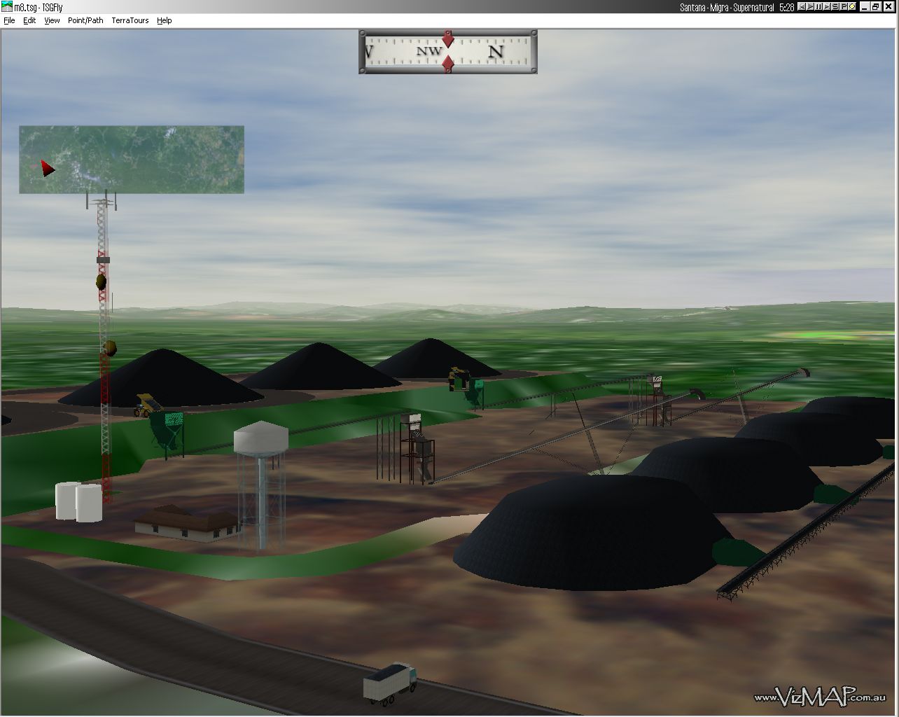
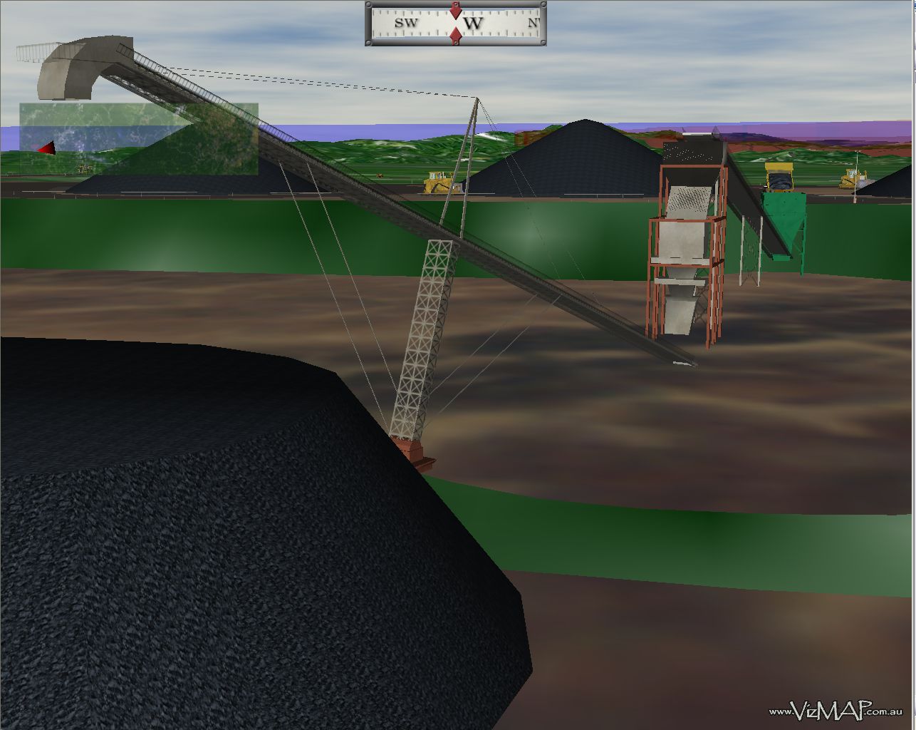
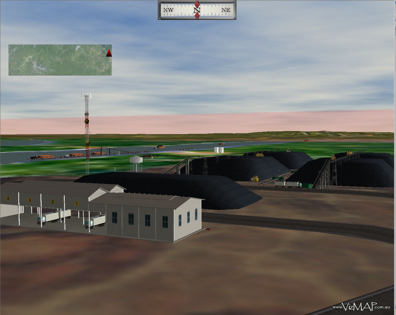
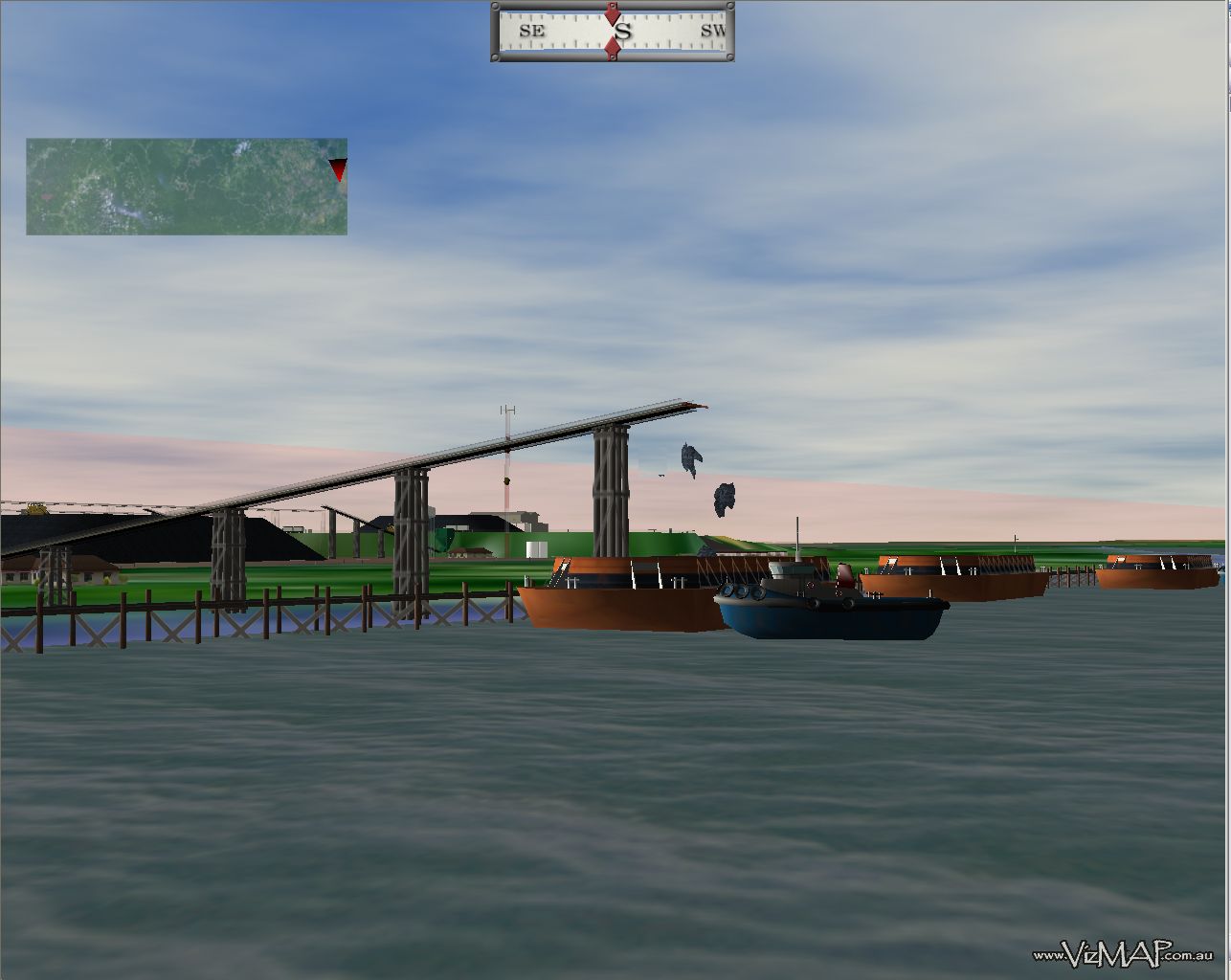
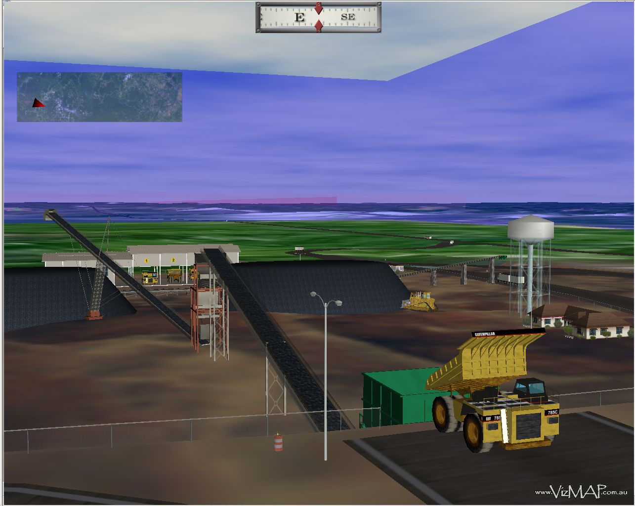
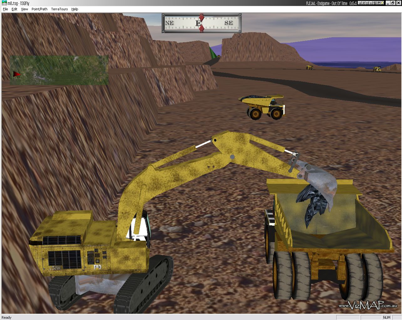
| VizMAP Pty Ltd was contracted by PT Asmin Koalindo Tuhup (AKT) to create a computer based visualisation of the complete mining facilities as planned to be when mining of the rich coking coal reserve in central Borneo is fully underway.
VizMAP used the TerraTools software from TerraSim Inc. (Pittsburgh, PA USA) to create the “virtual” 3D database. Supplemental 3D models of excavators, trucks, conveyors, bulldozers, barges and tugs, etc. were subcontracted. Landsat imagery provided the broad scale ground texture, whilst the SRTM (NASA Shuttle Radar Topographic Mission) data provided the bulk of the digital terrain modelling. Finer modelling, particularly of the actual mine site, was sourced directly from the mining plan and supplied in DXF.
Click on these small resampled images to view the full screen images on the VizMAP website. Bear in mind that these are just screen dumps from a dynamic, interactive application.
If you would like more information on this project, let VizMAP know |
||||||
| If you have a need to dynamically visualise your geographic data, let VizMAP know your requirements… |
|
|
||||||
Kalimantan Coal |
||||||
Powered by WordPress & Atahualpa |
||||||